|
|
|
|

|
|
© Stéphane Compoint
|
|
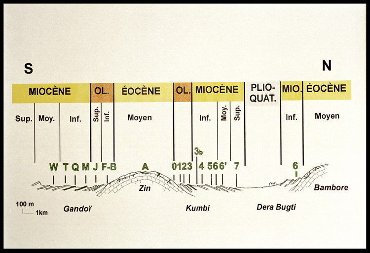
Map 4: The Zin: The combination of tectonic deformations and both wind and hydraulic erosion produced an exceptional geological configuration, a godsend for archeological exploration. The upturned layers created a kind of geological staircase, going from the oldest layers Eocene, 40 MYA) to the most recent (2 MYA). Thus fossils are exposed in their respective geological layer, making the study of 30 million years of flora and fauna significantly more productive.
|
|
|
|
Term of use: All pictures are © Stéphane Compoint except : pic n° 56 to 60 : © Gedeon Programmes (www.gedeonprogrammes.com)
|
|
|

